Feeds:
Posts

Posts Tagged ‘hiking’

Mau’umae Beach is my favorite on the Big Island (Hawaii). It’s secluded, sandy, and I can usually have it all to myself on a weekday if I get there early enough. The water is almost always calm so it’s a great place to snorkel. If you happen to be there during the winter months, keep a lookout for whales or dolphins just offshore.

Getting to Mau’umae Beach requires a short hike from Spencer Park or you can drive from the Mauna Kea Beach Hotel. If you’re coming from Mauna Kea Beach Hotel, you will need to get an access pass from the guard shack and they only give out 10 passes per day so go early. Once you have your pass, follow the road for approximately 300 yards and take the second right turn. Continue across two small wooden bridges until you arrive at the unpaved parking area above the beach. The trail down to Mau’umae Beach is marked by a sign.

From Spencer Park, park at the far left side of the parking lot and take the coastal path for about a quarter mile. Fishing is popular along the hike and the views of Mauna Loa are spectacular!

Mau'umae Beach hike ~ Ala Kahakai Trail Fisherman and mauna loa

Along the trail to Mau’umae Beach, woman fishing and Mauna Loa in the background.

If you’re on the Big Island, I highly recommend you visit this small, secluded and beautiful beach.

Read Full Post »

As a family, we’ve hiked in locations around the world and have been lucky enough to hike in Germany, Slovenia, Guam, Hawaii, Virginia, and many more. But I wasn’t surprised when my daughter deemed the Kīlauea Iki Trail on the Big Island as her all-time favorite hike. It’s a fascinating place located within the Volcanoes National Park on the Big Island of Hawaii. Kilauea remains an active volcano to this day.

fb-hawaii-kilauea-iki-trail-volcanos-national-park-sign
At the Kīlauea Iki sign, you can go in either direction but I would advise taking the trail to the right and hike counter-clockwise which will lead you through a rain forest, the 1959 lava lake, steam vents, cinder cones, and large fissures in the lava. Keep an eye out for the native nēnē (Hawaiian Goose) ~ we saw two but they were too fast to get a photo. The nēnē are the sixth most endangered waterfowl species in the world.

hawaii-kilauea-iki-trail-volcanos-national-park-bench-and-trail

hawaii-kilauea-iki-trail-volcanos-national-park-trail-v
The rainforest section of the trail is well-worn but be careful with the rocks and occasional exposed roots. We started early in the morning and didn’t see anyone else until we got to the lava lake.

hawaii-kilauea-iki-trail-volcanos-national-park-logan-on-phone-with-new-suitemates
On hikes, my daughter only uses her phone to take photos but while we were on the trail, her college released the dorm assignments and she was excited to learn where she would be living for a year. Unfortunately, it wasn’t the dorm she preferred and it was the only sad part of the hike. But, fast-forward six months later, and she’s thrilled with her suitemates and her dorm.

hawaii-kilauea-iki-trail-volcanos-national-park-logan-smelling-a-flower

hawaii-kilauea-iki-trail-volcanos-national-park-japanese-thimbleweed-ii

hawaii-kilauea-iki-trail-volcanos-national-park-ohelo-berries
The ‘Ōhelo berries are a favorite treat for the nēnē and can be found throughout the trail. It is a hardy plant that even grows on the lava. The plant is a relative to the blueberries and the berry can range in color from dark red to pale yellow.

hawaii-kilauea-iki-trail-volcanos-national-park-looking-onto-the-lava-field-trail
The amazing view from the rainforest.

hawaii-kilauea-iki-trail-volcanos-national-park-runner-along-the-trail
It was a little surreal to see a runner come through as we walked along the deserted and isolated lava crater but he obviously runs this trail frequently.

hawaii-kilauea-iki-trail-volcanos-national-park-marker-12
Be sure to follow the Ahu (stacked rocks) to find your way through to the other side of the trail. Please don’t disturb them!

hawaii-kilauea-iki-trail-volcanos-national-park-logan-and-patti-breaktime

If you go, here are a few words of advice:

  • The trail is moderate to challenging. It’s steep and rocky. The descent/ascent is 400 feet (122m).
  • It’s a 4-mile (6.4km) loop. It took us approximately 2.5 hours and we stopped for a snack.
  • The trail head is 2 miles (3.2km) from the Visitor’s Center.
  • Once you’re at the Kīlauea Iki parking lot (off of Crater Rim Drive), you may go either way from the trailhead. We preferred to go right which took us through the rainforest first then down to the crater floor.
  • Be sure to bring water, food, hat, sunscreen, camera and rain gear. Be prepared for all types of weather conditions: hot, dry, wet, windy (!). Please remember to “leave only footprints” and bring all your trash and items back out of the area.

hawaii-kilauea-iki-trail-volcanos-national-park-john-and-logan-resting-along-the-trail


Read Full Post »

A bit of Hawaiian history: In January 1778, Captain Cook made his first visit to the Hawaiian Islands while commanding the HMS Resolution and Discovery. He and his crew are considered the first Europeans to visit the Hawaiian Islands. Cook named the island chain “the Sandwich islands” after a patron named John Montague, the Earl of Sandwich.

Originally, the crew was welcomed by the Hawaiians who were fascinated by the large ships and the use of iron. While Cook re-provisioned his ships by trading metal, some of the sailors traded iron nails for sex. The ships made a brief stop on the island of Ni’ihau then headed north to look for the western end of the Northwest passage.

A year later in January 1779, the crew returned to the islands and docked in Kealakekua Bay. The Hawaiians were celebrating the fertility god, Lono and thought the English were visiting gods. Unfortunately, the crew spent the next month exploiting the Hawaiians. During that month, a crewman died which enlightened the Hawaiians as to the crew’s mortality and the realization that they were not gods. The Hawaiians were undoubtedly thrilled and only too happy to wave goodbye to the HMS Resolution and Discovery as they sailed out of the bay on February 4, 1779.

But wait…rough seas damaged the foremast of the Resolution and, after only a week, Cook was forced to return to Kealakekua Bay. As the ships sailed back into Ka’awaloa Cove, the Hawaiians greeted them by hurling rocks and stealing a small cutter vessel from the Discovery. Captain Cook attempted to negotiate with King Kalaniopuu but it all went sideways when a lesser Hawaiian chief was shot to death. Angry Hawaiians overwhelmed the 10-man shore party and Cook plus four sailors were killed. Before the two ships sailed back to England, the sailors retaliated by killing about thirty Hawaiians.

Kealakekua Bay Captain Cook Memorial II

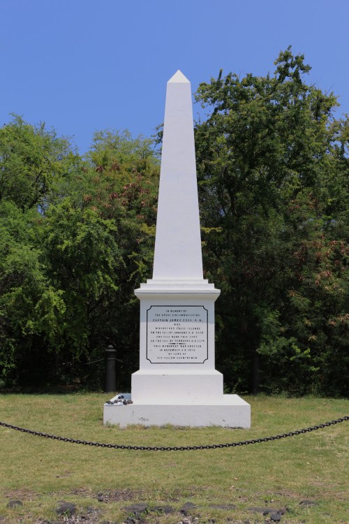
27-foot obelisk monument to Captain Cook was erected in 1874. The land under the monument was deeded to the UK in 1877. It’s considered as sovereign non-embassy land owned by the British Embassy in Washington DC and maintained by the British Consul–General in California.

Despite the unfortunate events in Hawaii, Captain Cook is regarded as one of the greatest explorer, navigator and mapmaker of all time. He mapped more of the earth than any other explorer. I try to imagine what it must have been like to travel as far and as wide as he did and in such arduous conditions. I complain about my 10-hour flight to Hawaii. Yet, he sailed for years on his ship.

Many people chose to kayak to Ka’awaloa Bay or take an organized boat tour there but we preferred to hike the Ka’awaloa trail. It’s a steep trek but worth it when you get to the bay and jump in the refreshing waters for a swim and a snorkel.

The trailhead is located off of Hwy 11. Turn toward to seaward side onto Napo’opo’o Road and drive to the third telephone pole which is where the trail begins. There’s limited parking and no shade so go early in the morning.

The signs at the start of the trailhead are self-explanatory. I second all of the “think twice” advice. We ended up on the trail in the middle of the day and there’s NO SHADE for a good portion it. On the way back up the hill, I had no shame and poured water directly over my head just to keep cool. I’m sure I looked frightful to other hikers going down. Can’t stress enough to going early. It’s a two-mile hike from the trailhead to the monument and there’s a 1,300 foot descend. It took me one hour going down and 1.5 hours on the return hike ~ I didn’t stop either way except for a water breaks. It’s not an easy and I would recommend it only if you’re in decent shape. Be sure to pack lots of water, wear a hat, sunscreen and sturdy hiking shoes.

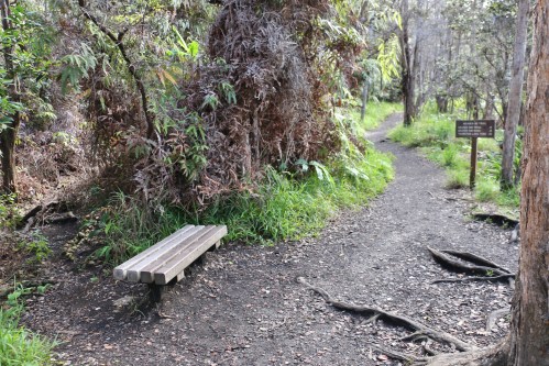
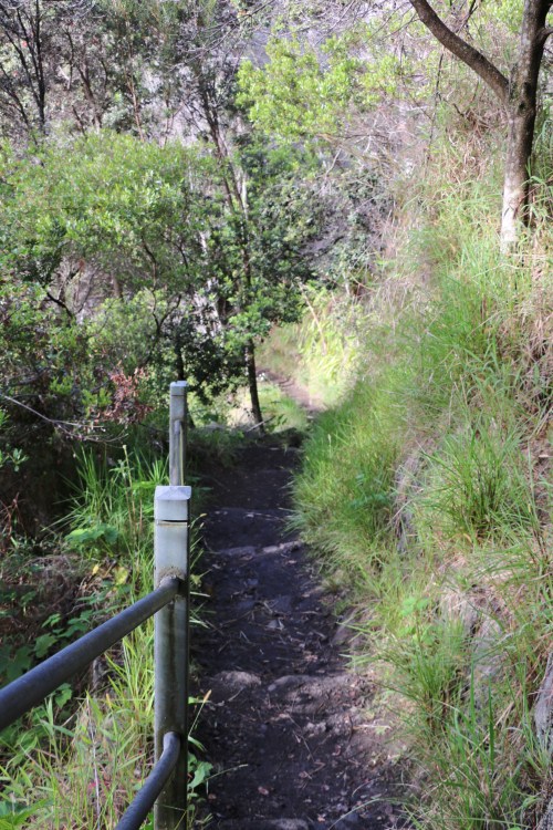
The following are photos from the start to the end of the trail:

Kealakekua Bay Trail Patti walking in the tall grass

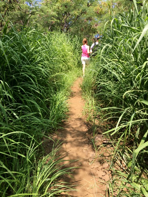
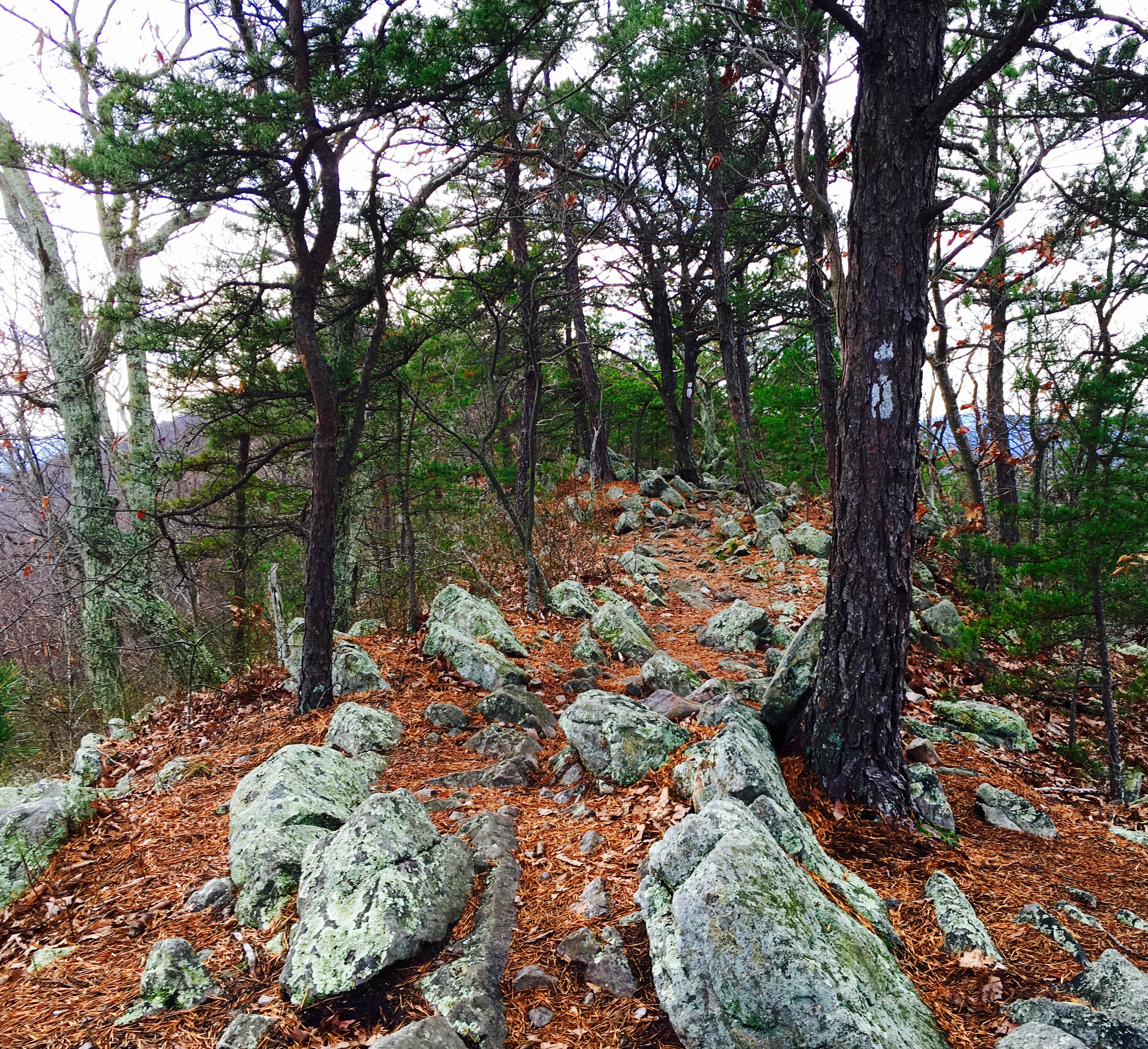
Upper part of the trail ~ tall grass


Kealakekua Bay Trail grassy part of the trail

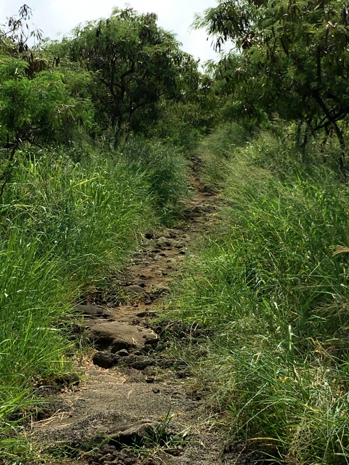
Middle part of the trail

Kealakekua Bay Trail Marker 6

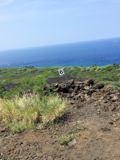
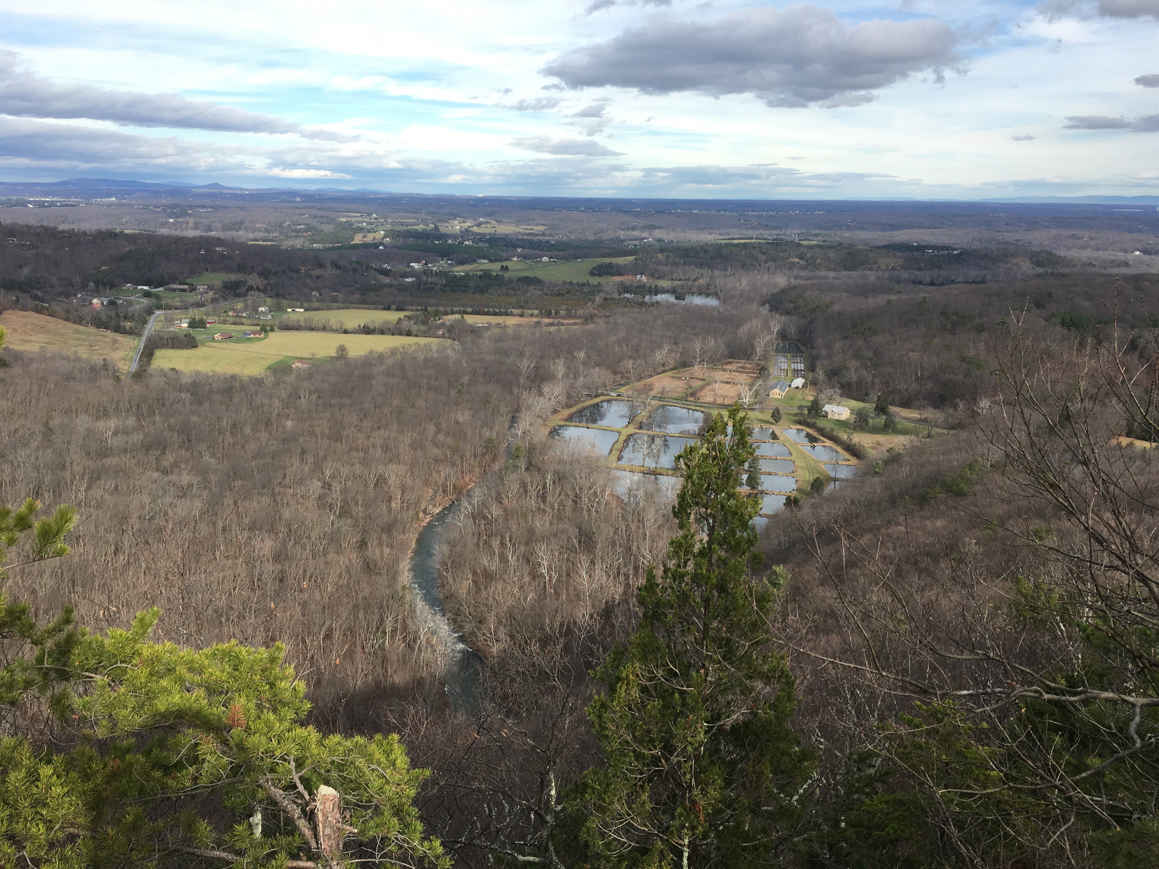
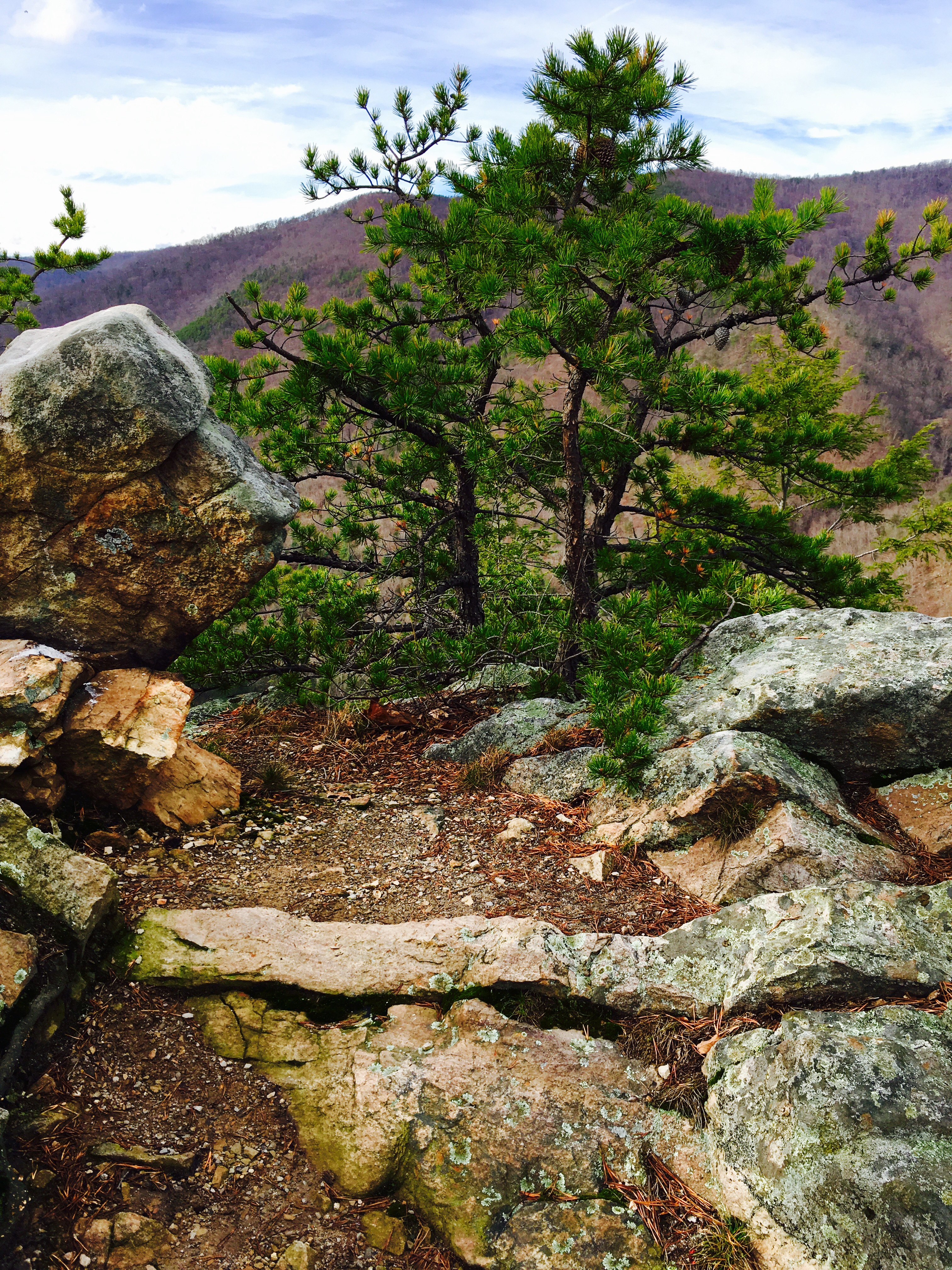
Marker 6 means you’re almost there…and the views are spectacular

WP Kealakekua Bay Trail view to south side of island

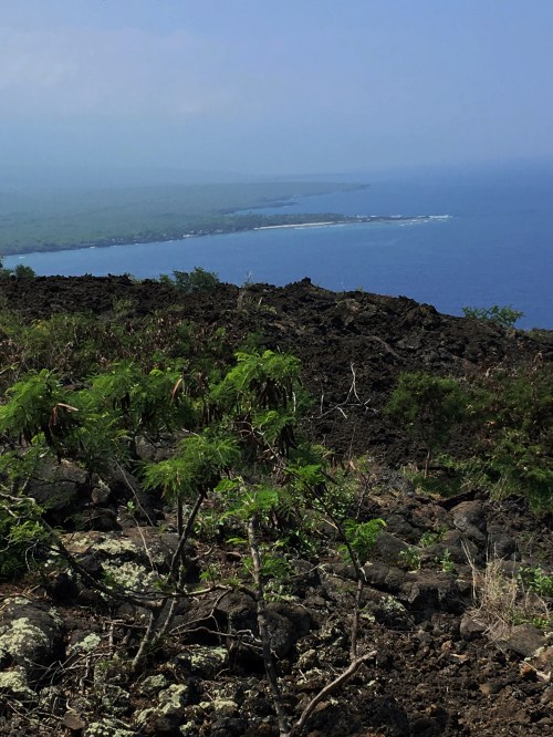
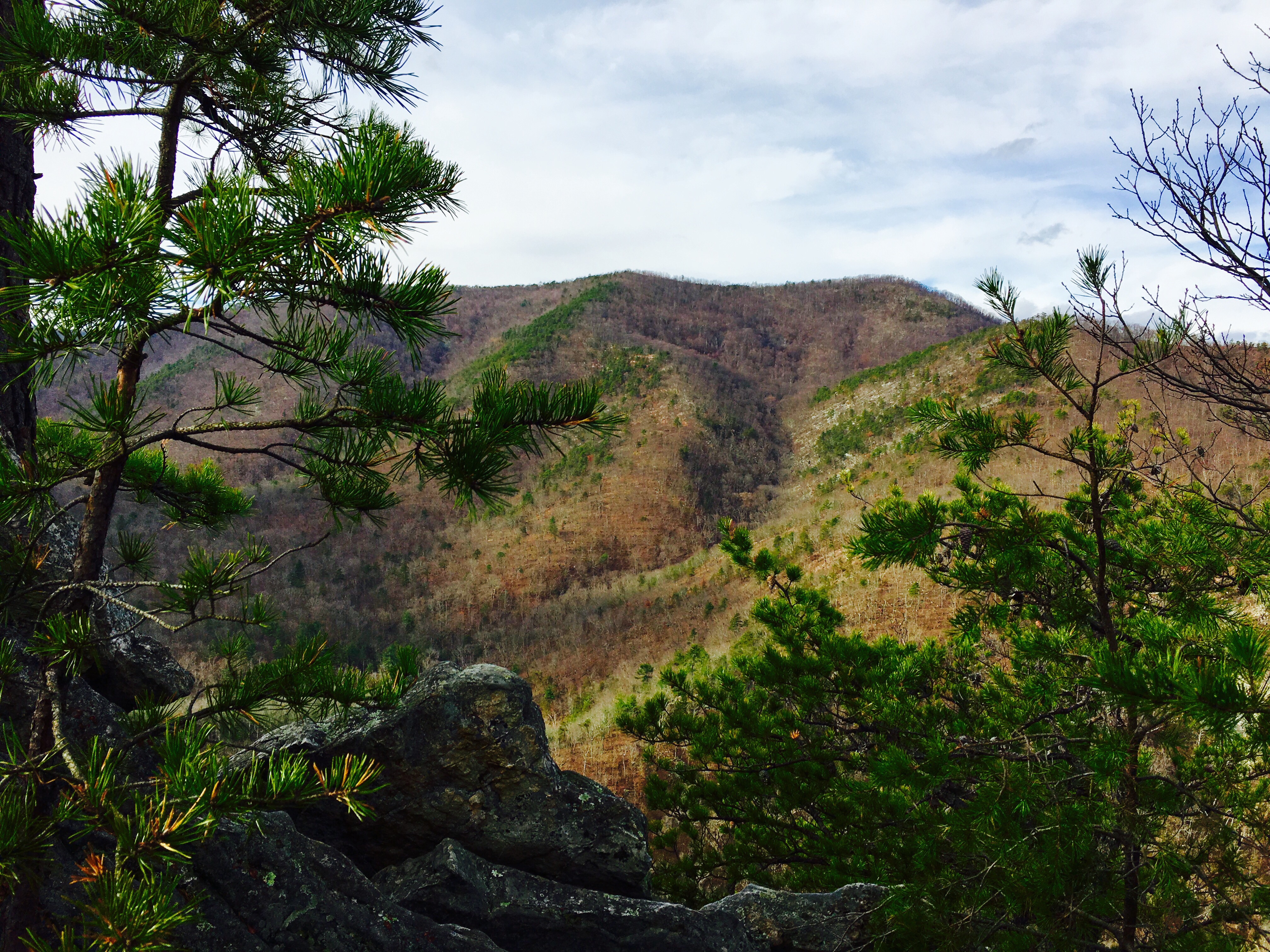
Beautiful view along the Ka’awaloa Trail (to Captain Cook’s memorial marker). No shade to be found!

WP Kealakekua Bay Trail Marker 8

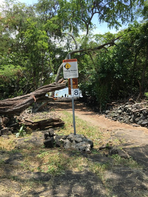
Marker 8 means “you made it!”

Kealakekua Bay south side IV

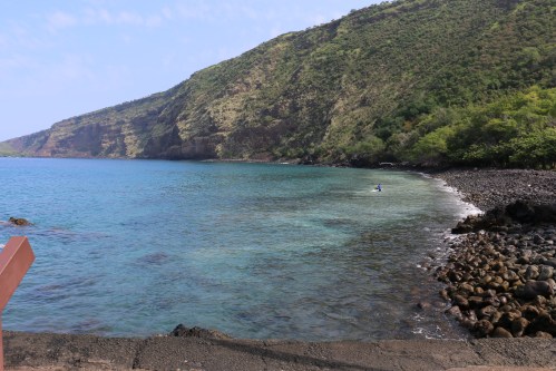
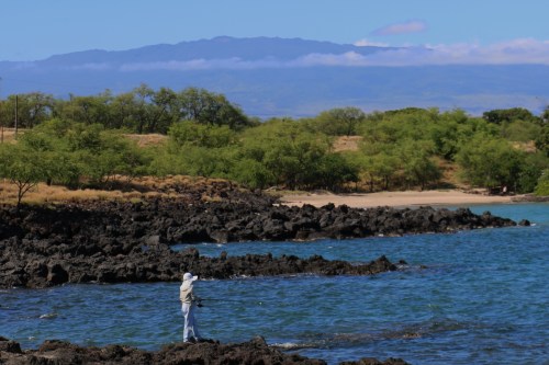
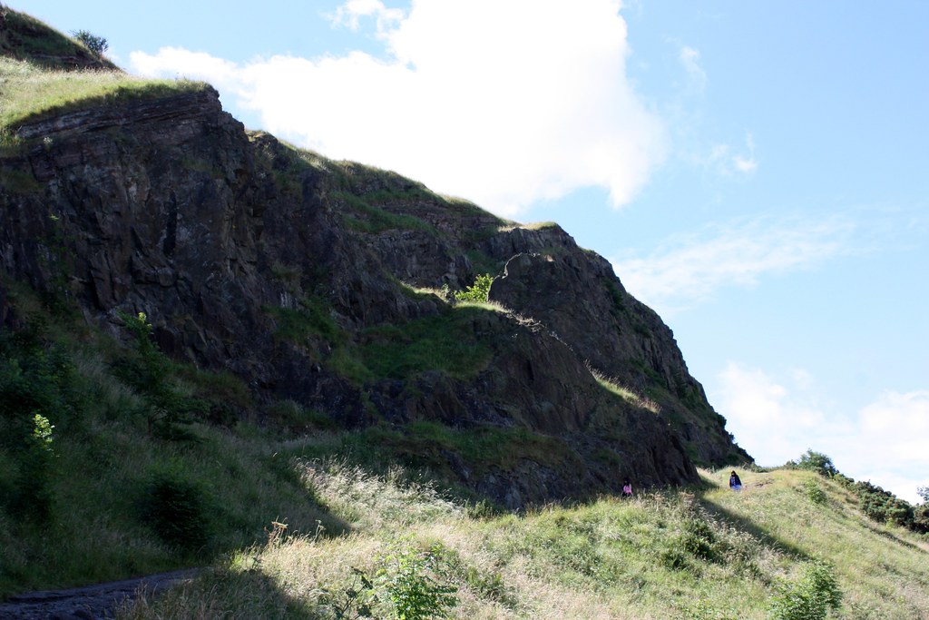
Kealakekua Bay ~ Cook’s monument is located on the far side of the bay.

Read Full Post »

We decided to take advantage of the record-breaking warm temperatures this winter and go on a hike to celebrate the last day of 2015.   At the top of Buzzard Rock

Located in the George Washington National Forest , just west of Shenandoah National Park, is the Buzzard Rock trailhead. It’s just outside Front Royal and the address is 3087-3189 Mountain Road/Route 629. Parking is limited (if it’s full, see the link at the end of this post for larger parking areas). The drive from Washington DC takes about an hour and a half.  The 1.5 mile trail is marked with white spray paint on either a tree or rock along the path. At the beginning, the terrain is rolling and  gentle with a sprinkling of small creeks and a campground area. As you approach the top, the hike becomes steeper and rockier.   Beautiful stream My daughter jumping across the stream
For all the biology enthusiasts: lots of lichen along the trail. My favorite is the blaze orange…  Looking out toward the Front Royal Fish Hatchery and Passage Creek.

Note the white marking on the tree on the right. Good thing there are marks because some areas become a bit rocky.   At Buzzard RockThe views are lovely, even in the winter. I’ll be back to see the scenery in spring and autumn…

A quick comment on hiking etiquette: Most hikers we saw, greeted us with a “hi” or “hey”. But almost all of them didn’t realize hikers coming down should yield to hikers going up. Also, hike quietly ~ there was one woman speaking loudly into her cell phone as she walked down the hill (not stopping for us as we were ascending) and her partner gave us an embarrassed shrug.

If you decide to go, you can get detailed information, maps and how many calories you burn on the hike: here.

Read Full Post »

After a filling breakfast at Premier Inn (included in the room rate), we decided to visit Holyrood Park and hike to the top of Arthur’s Seat. We chose the steeper ascent. For some reason, I thought it would be a faster route but not so much. Just before the summit it becomes a bit steep and very rocky so good walking shoes are a must. We saw a few people in sandals struggling not to slip on the rocks. I’m certainly feeling it in my legs this evening. At 251 meters (823.5 feet) high, we were rewarded with a beautiful view from the top!

Edinburgh the hike up Arthur's Seat
Along the trail to Arthur’s Seat

Edinburgh Arthur's seat almost to the tip top
Almost to the top!

Edinburgh Ruins of St Anthony's chapel
Ruins of St Anthony’s Chapel, Holyrood Park

Top of Arthur's Seat
Made it to the top

View from Arthur's Seat
View from the top of Arthur’s Seat

And because I still can’t get over the view from our room in Edinburgh, here’s one at sunset

Edinburgh Sunset on the castle

Read Full Post »

Dover is an easy day trip from London and well worth the train ride. We caught the 10:10 train from St Pancras and made it to the Dover Priory station by 11:15. The taxi from the train station to the White Cliffs of Dover Visitors Center cost £7 and took 15 minutes. We ate lunch then headed out for a hike around the area. The visitors brochure listed the Top Five Things to Do while in Dover:

  1. Watch the hustle and bustle of the World’s busiest passenger port  ~ check
  2. Enjoy a gentle stroll along the famous White Cliffs of Dover   ~  check
  3. Catch a glimpse of France on a clear day ~ sadly, despite the warm temps and sunshine it was too misty to see France across the channel
  4. Experience a wonder of Victorian engineering at the South Foreland Lighthouse  ~  check
  5. Discover the rare plants and insects that make the cliff top their home   ~ don’t think they’re rare, but I loved the poppy fields

Dover Cliffs

White Cliffs of Dover

Dover beach view

The cliffs are gorgeous and we lucked out with a sunny and warm day to enjoy a two mile hike to the South Foreland Lighthouse.

Dover foot Path Sign

The pathways are marked with the purple or pink trail signs. We had no problem finding our way but I can imagine on a heavily misty day, it might be difficult to know where you’re going.

Dover Light House

The South Foreland Lighthouse was built in 1843 and guided boats safely around the dangerous Goodwin Sands. It also claims to be the first lighthouse to use electric light.

Dover view from lighthouse
View from the lighthouse

Dover Poppy Fields
Poppy Fields

Dover looking over the edge

Looking over the White Cliffs of Dover

Dover Gull nesting
Seagull nesting

Dover Gull and Rocks
Along the rocky coastline

Dover Ladder to beach
Climbing down the ladder to the beach area

Dover ladder to the beach
Logan on the ladder to the beach

Dover Lighthouse desk
Desk items at the Lighthouse

As always, we love exploring the English countryside…

Read Full Post »

Morning Snow in Inverness

Morning Snow in Inverness

We finally decided if we’re going to be on vacation during record cold temperatures, we should “embrace the suck snow” and appreciate the beauty of winter. As we drove from Inverness to Glasgow, we took a detour to the Nevis Mountain Range  The Nevis Mountain Range has the tallest mountain in the UK: Ben Nevis. After taking a cable car to the top, we hiked even higher. Basically, we were saying “bring it on Mother Nature, we can handle the I’m-so-cold-my-eyes-are-watering-from-the-wind-and-then-freezing-on-my-cheeks cold.”

Driving along Loch Ness

Driving along Loch Ness

Heading Toward the Nevis Range

Heading Toward the Nevis Range

Nevis Range Cable Car

Nevis Range Cable Car

Cable Car Looking Back

Cable Car Looking Down the Mountain

Reaching the snow line

Reaching the snow line

Squrr Finnisg-aig View Point 663m (2,175 ft)

Squrr Finnisg-aig View Point 663m (2,175 ft)

BLUE SKY!

BLUE SKY!

Snow Boarder

Snow Boarder

Looking Back at Nevis Range Mountain Resort Ski Hut

We're Still Smiling ~ frozen but smiling

We’re Still Smiling ~ frozen but smiling

Highland Cattle

Highland Cattle

Bridge

Bridge

Glen Coe (about half way between Inverness and Glasgow

Glen Coe (about half way between Inverness and Glasgow

Loch Lamond

Loch Lamond

Beautiful Loch Lomond

Beautiful Loch Lomond

It’s a beautiful drive from Inverness to Glasgow. It took us about six hours including the cable car stop and another 45 minute stop for lunch. If you’re driving slowly, there are plenty of “pull over and park” places so other cars can get by. We wanted to enjoy the beauty of the area so we took our time.

Read Full Post »

We opted for a private boonie stomp for our finalé since the organized stomp yesterday was rated VERY difficult and didn’t end at a beach. My daughter stayed with her favorite sitter rather than head out to the boonies with us. It was probably just as well since it was a hot, long, and definitely “in the boonies” kind of hike and she had more fun playing with her friends. John and I were rewarded with this:

My favorite thing after a long hike was jumping into the cool, refreshing ocean waters and that’s the first thing I did:

Double Reef is one of the more remote beaches and, by far, the best snorkeling we’ve encountered on Guam. The ocean was very calm and we were able to swim quite a distance out to a “drop off” ~ there were so many fish and a variety of coral. I was mesmerized by all the vibrant colors of coral.

The beach itself is surrounded by a rugged, limestone forest (think “Predator” the movie) and there are giant binalo trees whose branches extend completely over the beach thus shading almost the entire length of the 150 feet long white, soft-sand beach. Absolutely gorgeous!

Much to our dismay, and I’m sure the other couple’s dismay as well, we weren’t the only ones there. We caught up with them on the hike and arrived at the beach at the same time. They went out for an even longer snorkel then we did, so we enjoyed a little time alone on the beach.

Along the trail, we came across wild pigs. I decided to carry a stick to ward off any attacks. Now that I look at it in the photo, my best hope would have been to poke it in the eyes with that lame stick:

I had heard many people tried to make it to Double Reef but couldn’t find it. I can see how that could happen. I highly recommend any one living on Guam, who plans on Boonie Stomping, buy the book “The Best Tracks on Guam” by Dave Lotz. It is very detailed and gives step by step guidelines to all the best hikes. And thankfully, there were markers along the way so we knew we were heading in the right direction. We did get off track a couple times but thankfully I was with John who has a great sense of direction. Not to mention he’s spent a lot more time in the woods. This is John standing next to a major marker ~ if you don’t turn right here, you’re way off course:

For anyone interested in hiking to Double Reef, be sure to park at this sign and start down the dirt road:

As the sign says, be sure to check in with the security desk. They will let you know if the beach is closed due to training ~ heed the warnings, you don’t want to get ‘shot’ accidentally. UPDATE: I’ve been advised, in the comments below, that hikers must sign a “release” prior to hiking to Double Reef beach.

It’s a rough hike but worth the reward at the end! Take lots of water, sunscreen, bug spray and snorkeling gear.  I’m trying to figure out how we can fit one more hike there before we leave.

Read Full Post »

After several weeks off, mostly due to rainy weather, we returned to Boonie Stomping. We explored the southeastern coast and ended in the village of Inarajan. It was a beautiful day ~ sunny, clear and, most importantly while hiking, not too hot. The drive to the area is spectacular. Gorgeous views of the ocean and the southern part of the island is much less developed. Our hiking guide got permission for us to park at someone’s house which sat right on the beach ~ so lovely.  As always, we were welcomed by the local hospitality.

The entire five mile hike to Bear Rock, at Agfayan Bay, was along the coastline in water up to my knees. Talk about a good workout for my legs. Can you make out the “bear” in the photo below?

There were a few waves which made me a little leery and concerned for my eight years old but we were able to time it so we made it through without getting pushed around too much by the water.  Being from Hawaii, I have a healthy respect for waves and never turn my back on the ocean. Sometimes there are rouge waves lurking…

On our way back home, we stopped at a fun seaside restaurant called Jeff’s Pirates Cove for a late lunch.  It’s a tourist stop but you can’t beat the atmosphere, beach-side location, good food and fast service.

Read Full Post »